Three Musketeers Tour South Florida . . . and go home
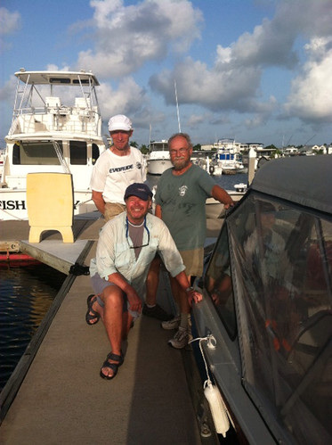
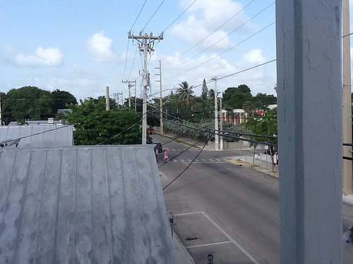
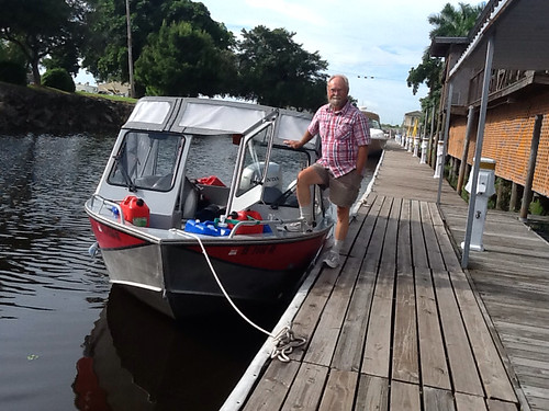
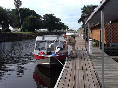
Day 67. Knowing that we had to get about 140 miles up the coast and into a marina in Miami today before they closed, Phil Berg, Dave Hewes and I got an early start from the Key West City Marina (Phil's the one kneeling).
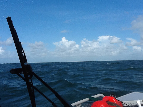
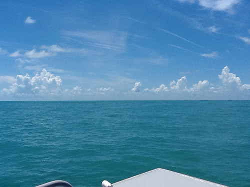
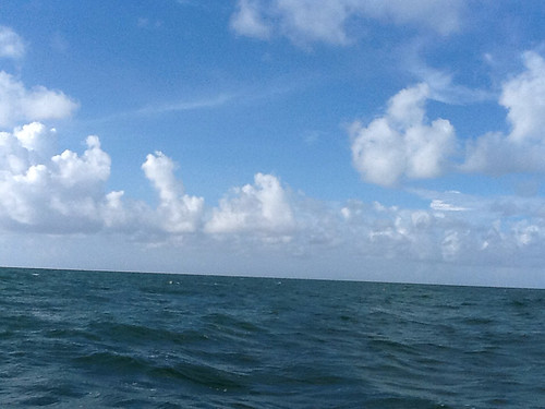
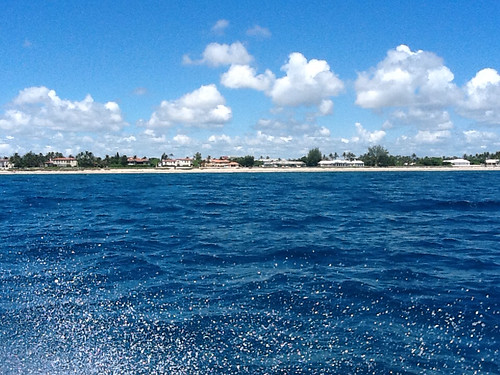
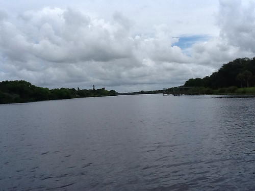
The weather report indicated easterly winds gusting from 10-15 mph, so we knew we would be bucking the seas all the way back to Marathon. We motored around the west side of the Key, out into the Atlantic to the Hawk Channel route I had mapped on the GPS chart, and headed east.
We were fortunate to only encounter 1-2 ft waves generally, because we needed to make decent time. We maintained 22-23 mph, which was as slow as the boat could run and stay up on plane. This was a pretty tolerable level of slamming along, as long as we cut the speed when hitting a bigger "rogue wave", because that involved serious pounding. Dave and I rotated sessions at the helm, and Phil found that the best way to put up with the impact was to lie flat on one of the bench seats behind the console seats. This was our process for 4-1/2 hours until we ran under the causeway at Marathon, into quieter water on the Florida Bay side of the keys.
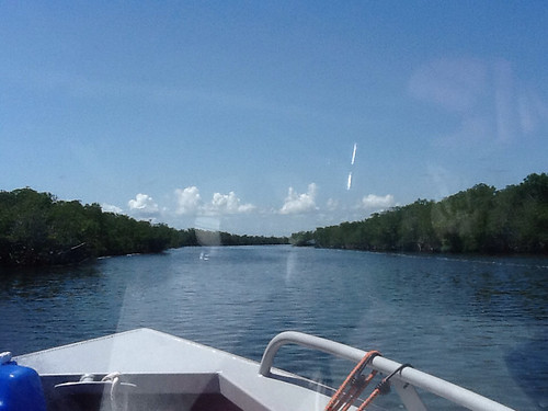
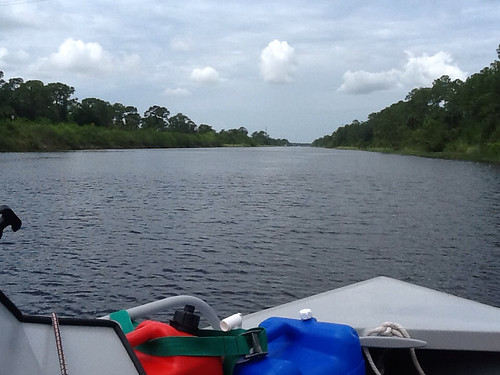
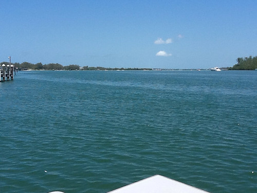
After refueling at Captain Pip's Marina, we headed north up the Intracoastal along the remaining keys. As we neared the mainland we encountered steadily more islands, and from time to time the channel ran through them.
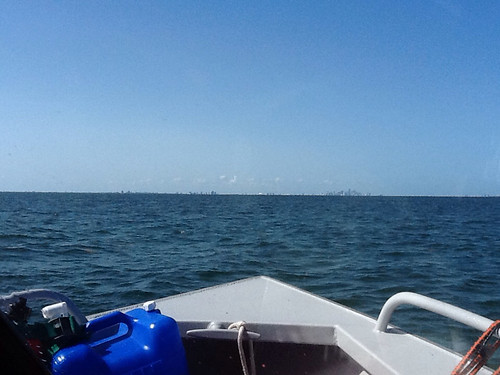
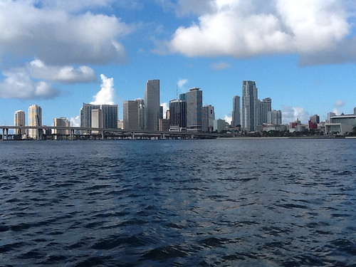
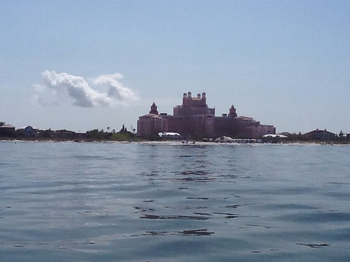
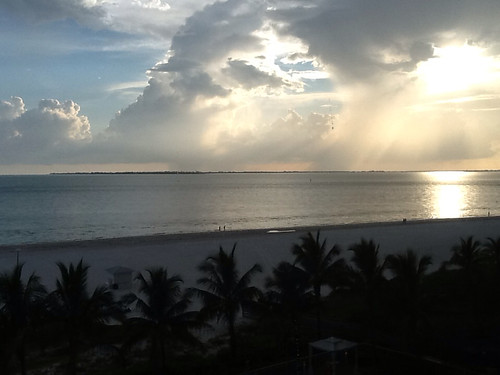
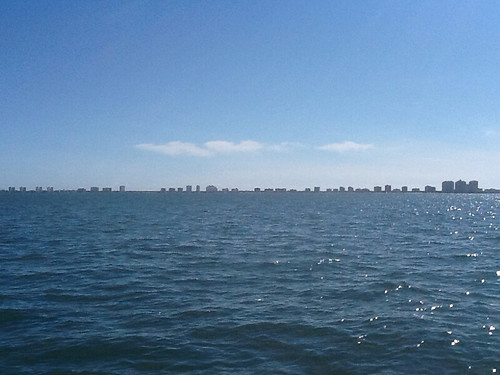
We made very good time all afternoon, pushing hard. After crossing a couple of smaller bays, the channel opened out into the wide and very long Biscayne Bay. Thankfully the chop was light, so we could continue running hard. After a very long haul, we finally sighted the first skyscrapers in the distance (like Dorothy with the Emerald City coming into view).
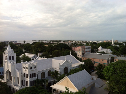
We thought we were close to Miami, but it took another couple of hours before we pulled into the first No Wake zone there and motored slowly past downtown to our marina, arriving shortly before closing time. The Miami skyline is impressive.
Sea Isle Marina is not impressive, in my estimation. Every aspect was a little irritating, from trying to refuel to getting situated in our slip. We were not impressed with the management. But, it was adequately equipped and very secure, and Little Sadie was in for the night. We retreated to Springhill Suites for the night, where we had lovely accommodations, a very good supper (black bean soup and a Cuban sandwich for me, in Miami what else?), and the best free buffet breakfast we had ever seen.
Day 68. Back at the marina, a local yachtsman confirmed our fear that if we went north through the protected Intracoastal Waterway (IWW) we would have trouble making the ninety-odd miles up the coast to Stuart today, because of all the No Wake zones/Manatee zones. The weather report indicated moderate winds, but from the east-southeast, so the seas would be from the side and behind.
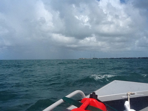
We ran out into the ocean through the Government Cut, the main Miami ship channel. As we reached open water, we were suddenly bucking serious 4-5 ft. waves and I thought we would have to turn back into the IWW. But, as we pushed a little further and turned north, the seas moderated to the level we were expecting. I later learned that there is a lot of current and turbulence as water funnels into that narrow channel.
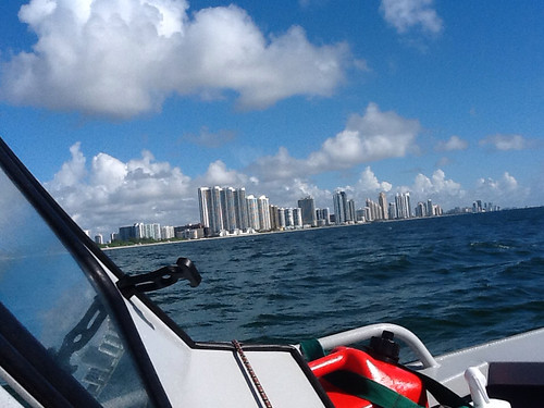
We progressed northward, and were struck by the "gold coast" of high-rise condos and hotels that went on literally to the horizon north from Miami. This made what I had seen on the Gulf coast seem "sparsely populated" by comparison. What a glut of beachfront construction. And money. As we went north, the high-rise skyline rose up periodically, around centers like Hollywood, Ft. Lauderdale, Pompano, Boca Raton, Palm Beach. It was a pleasant relief for me to see stretches of just one-story, single-family affluence.
This day was somewhat smoother than the run up the Keys, but still a steady diet of banging along. We made good time, however, and by mid-day went inside at the Jupiter Inlet. We chose to run the last 20 miles up the IWW because of a report that the St. Lucie Inlet might be shallow and hard to navigate. In due course we reached the intersection with that river, turned left and followed it to the Monterrey Inn & Marina, just past Stuart. We had to pick our way through shallows (a well-developed talent of mine) to get into a slip at the marina, but once in, this was a very adequate place to spend the night.
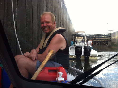
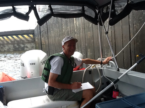
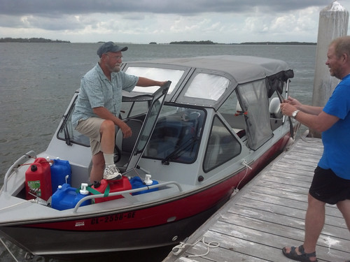
Day 69. This morning Dave ran up to nearby Ft. Pierce to visit the factory of Maverick Boat Company, who make the renowned Hewes light-tackle boats, used for fishing in shallow-water flats. Amazingly, that Hewes is no relation to Dave's family who have made aluminum boats in Washington state for over a half-century. Upon his return, we left hurriedly to get to the first of several locks on the IWW going across the state -- because this one only opens on the odd hour. We did get there in time, and went through with two other waiting pleasure craft. I was pleased that I now had two crew members to man the bow and stern lines in the locks, so I could just drive and take pictures. Here are busy Phil and multi-tasking Dave.
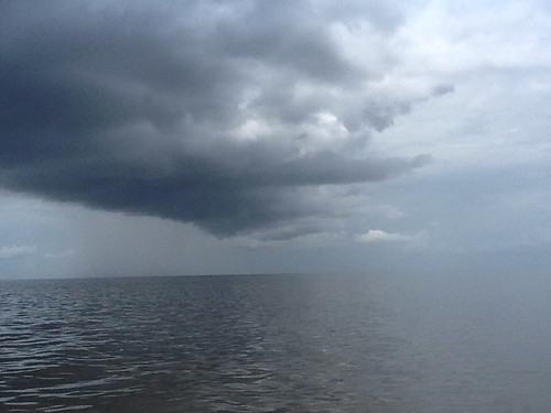
We had a 30-mile transit through the St. Lucie Canal to Lake Okeechobee, and were watching storm clouds building ahead.
Happily, at mid-day we reached the next lock at the entrance to the lake and found it was currently being kept open. The water level in the lake was not significantly different from that in the canal. We started across the 30-mile-wide lake and were pleased to see the dredged channel was well marked and charted on the GPS. We buttoned up as we approached a rapidly-building storm cell, but our intrepid helmsman Dave pushed on and the channel took us under the edge of the storm, so we mainly encountered rain.

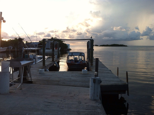
After clearing the storm we motored into Clewiston, where we had reserved a room at Roland & Mary Ann Martin's Marina. (Roland is the TV bass-fishing guy, I'm told.) We refueled and tied up along their dock and checked in. Imagine our surprise when they said there was a problem with the room we had reserved -- and they were upgrading us to a condo for the same (very reasonable) price. We enjoyed a fairly luxurious condo (swimming pool, etc.) for the night. Dave and I posed with Little Sadie as we got our bags out.
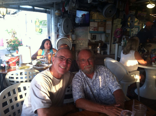
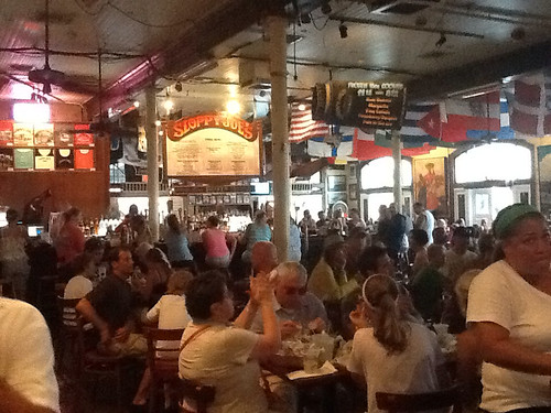
This was Friday. The open-air tiki bar at Roland Martin's is a happenin' place in remote Clewiston on a Friday night. We had a very good supper there, then Dave retired to do some emailing and Phil and I settled in to enjoy the pretty good blues/country/southern rock band. The music was great and the people-watching in this redneck cluster was as well. After a time, I wandered over to the open windows overlooking the dock, to check on Little Sadie in the failing light. I was struck that she was there, tied up and waiting patiently like my dog on his chain, and I felt an affection for the little boat akin to one's feeling for a faithful pet. Almost shed a tear. Must have been the vodka-tonics.
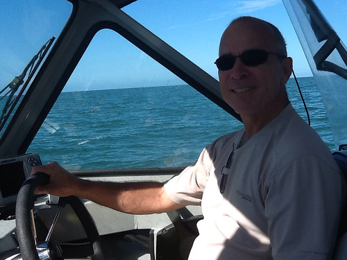
Day 70. We were halfway across Florida, so had to go some 70 miles today to Ft. Myers, and another 25 miles north on the GIWW to Cabbage Key, our island destination. And, on the way we had to negotiate three locks on the Caloosahatchee River, the drainage from Lake Okeechobee west to the Gulf. The third of these locks was another one that opened only on the odd hour. To make the 1:00 opening, Dave and I were pushing all morning, running along the river at 30-32 mph. Again, Phil elected to not do the driving chore, which was fine because Dave and I enjoyed it. As luck would have it, we arrived at the lock about ten minutes early, which couldn't have worked out better.
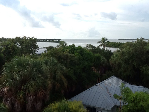
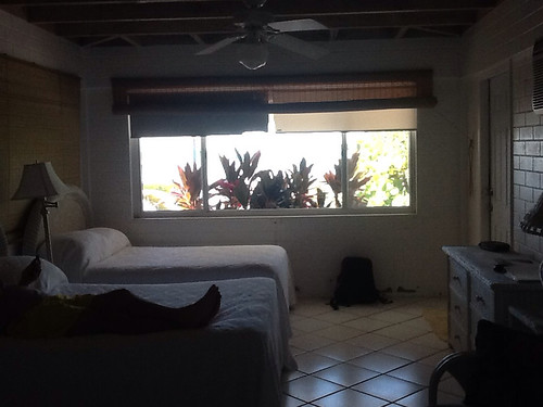
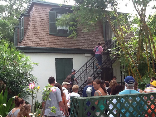
Things were a bit busy and confusing through the sprawling Ft. Myers area, but we followed the IWW path on the GPS and another boat that was also making for the Gulf Intracoastal north, so we made no wrong turns. I had set a GPS waypoint on the coordinates of Cabbage Key in Pine Island Sound, so we readily recognized it and motored up to the dock by mid-afternoon. Jeff the Dockmaster got us situated in a slip in the midst of patiently ushering all the boating-over-for-lunch locals in and out of the docks (like herding cats, I thought). We got checked in and shown to our room by our friendly hostess Marlene, and started to survey the place.
I was happy to get a room in the inn here, because my relatives Ray and Cathy had described it as a unique and delightful place to stay. It is great. Originally the 100-acre island was owned by a wealthy couple who built their home here. Then in 1944 new owners turned the home into an inn and built several cottages on the island as well. It is touted as a slice of "old Florida", and it is a very charming, rustic, laid-back place to stay.
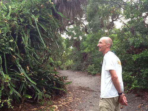
Dave and I walked a lengthy nature trail, exploring the jungle flora, and climbed a watch tower to survey the scenery from the center of the island.
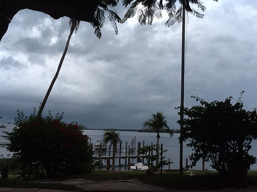
Phil and I sat on the front patio and basked in the balmy day until a large storm moved in and moved us into the inn.
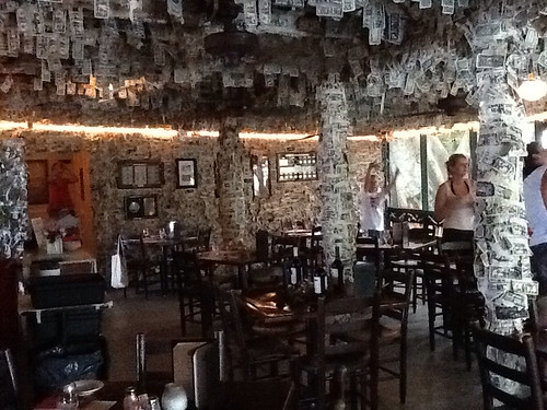
We had excellent seafood dinners in the open-air dining room, now quiet because all the day-trippers had boated back to Ft. Myers, Port Charlotte or wherever. (I failed to mention that a boat is the only way to access Cabbage Key, save maybe a helicopter.) The main dining room has been decorated for decades with dollar bills taped up by patrons, giving it a shaggy feel.
Unlike our earlier accommodations, our bedroom had two smallish beds and not much floor space. Since it was Dave's turn at the "extra" bed, he opted to bed down on a Therma-Rest on the adjoining screened porch. It was hot and humid, of course, and he did not have a good night.
Day 71. After breakfast we recognized that a huge storm system was coming toward us from the south. We hurried and got underway, and once back on a northerly course in the GIWW, set about outrunning the storm. By the time we crossed Charlotte Harbor we had pretty much done that.
I advised Dave and Phil that since this was to be the final day of my cross-country odyssey, I'd like to just pilot Little Sadie on in to Tampa. They agreed. We stayed inside on the Intracoastal through the canal stretch up to Venice Inlet, and then moved out into the Gulf to avoid numerous No Wake zones. There was some threat of thunderheads building, but they fortunately dissipated.
We ran up the coast, following the underwater topography lines on the GPS to stay far enough out, and bounced along in moderate seas. When we reached New Pass we turned to go into Sarasota Bay. I saw a light-colored strip (deeper water) heading in there on the GPS, and without seeing buoys marking a channel in real life, started to follow that strip in. About the time we saw a boat speeding along off to our right, following small buoys, I realized I was in two feet of water and running aground. I had not seen the small print identifying my "deep-water strip" as Abandoned Spoil Area, which is the place they dump the stuff they dredge up out of the channel. We were out on a broad shallow flat.
I hurriedly raised the motor almost out of the water and raced it as we labored, painfully slowly, toward the channel across some twenty yards of frightfully shallow water. Montana deja vu all over again. We slowed almost to a stop, pushing along on the sand, and I had Dave run up front with Phil and me. That seemed to raise the stern just enough to let us break free and slide out into deeper water. The GPS chart had served me exceedingly well over these many weeks, but obviously I was still hanging precariously on its learning curve.
After a most enjoyable lunch with Phil's long-time friends Kristey and Tom Richardson, we headed north up Sarasota Bay. We soon passed Bradenton and Anna Maria Key and by mid-afternoon were out into open water where the Intracoastal crosses the ship channel under the Sunshine Skyway Bridge into Tampa Bay. A storm was developing to our west, and the water was getting rougher, but not too rough for a portrait with the Skyway in the background.
We made our way north up past the Gulf side of the bridge, and soon turned west into the channel into Fort DeSoto island and the boat ramps there. After some more picture-taking, we took down the boat top and stowed all the gear as well as we could, before a drenching thunderstorm drove us to cover ashore.
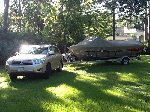
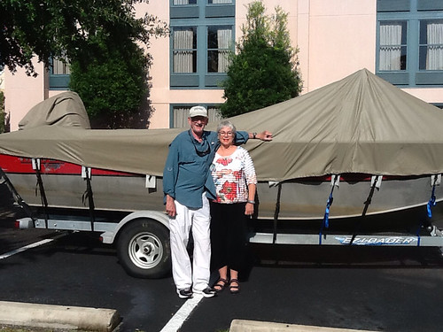
My brother-in-law Ray and sister-in-law Cathy arrived with my car and trailer, and the rain storm moved on. We trailered Little Sadie and all went back to Cathy and Ray's for the night. The 71-day boat trip was at an end.
EPILOGUE. The next day I put Dave and Phil on a plane to Denver (which turned out to be the first leg of Dave's trip home to Colville, WA). I hadn't known how the three of us would do in close quarters for five days, but we had a great time. We became great friends, through a little adventure, plenty of interesting new sight-seeing, and lots of laughs. I spent the rest of the day hosing and scrubbing down the boat, storing all the gear, and cinching down the cover. The next morning, offering many thanks to Cathy and Ray for all they had done, making much of the Florida part of the trip possible, Little Sadie and I headed for home.
I timed my return to rendezvous in Tallahassee with another Navy buddy, Jim Pearce, and his wife Mimi, dear friends for decades. They came over from Jacksonville and we had a memorable evening catching up on my trip and our lives since we had last gotten together.
It also worked out that I could participate in an informal annual gathering of the alumni of my high school near St. Louis. I joined about forty Western Military Academy alums at the Loading Dock bar and grill on the shore of Alton Lake in Grafton, IL. Though it was a rainy afternoon, we were under cover and had an excellent gathering. I saw a few more classmates that I hadn't seen in decades.
After two more days, I returned home to the foothills outside Denver and backed Little Sadie down the driveway to her spot next to my '49 Ford pickup.
My
Hewescraft boat had served me well. The size and shape of the 200 Pro-V was
optimal for the range of conditions I would encounter. The design worked
well for a ten-week camper "living space". And I was MOST grateful for
Little Sadie's reliability and durability.
Like Odysseus, I enjoyed the fact that my old pup Riley immediately recognized me. And Delly and I were glad to have me home.
Acknowledgments: This extensive bucket-list voyage would have been more difficult or impossible without the help of the following, in no particular order: All my shipmates (George, Larry, Randy, David, Rachel, Adam, Bryan, Cathy, Delly, Ray, Dave & Phil), Nan & George Ingersoll, John Zeck, Phil Berg, Ray Gadd & Cathy Peckett, Dr. Jim Allbright, David Miller (The Complete Paddler), Ted Meeker, John Salter, Larry & Elizabeth McPhail (DuroBoat), Sam Evans (Captain's Choice), Capt. Bruce Peterson (Yacht-Pro), John Stamas (Stamas Yachts), Laura Cannell (Marine Navigation), Austen & Dave (Valentine's Marine), Michele & Paul (Paul's Custom Canvas), John Gunter & the folks at Northwest Marine & Sport, Dave, Clint, Brian & the folks at HewesCraft, Lowrance, Navionics, and Honda Marine, all our gracious marina hosts, my wife Delly . . . and everyone who gave us a good word or a helping hand that I've failed to mention here.